TLP:CLEAR · Disclosure is not limited.
Red Sea Shipping Disruption: Yemen Escalation Raises Risk, Not Closure
Time window: Last 7 days · Audience: General analyst · Type: Situation report · DTG: 2026-11-02 10:29Z · Overall confidence: HIGH
BLUF
Commercial shipping through Bab el-Mandeb is likely to remain exposed to Houthi attacks and spillover from Saudi-Houthi fighting over the next 0-14 days, but reporting does not establish a closure. The Saudi-led coalition acknowledged an operation against Houthi resources on 1 November; reports of strikes on Ras Isa port remain unverified at the site and damage level.
Executive summary
Between 26 October and 2 November 2026, reporting describes continued maritime threats and sharper fighting in Yemen. The Saudi-led coalition said it conducted an operation on 1 November to neutralise Houthi resources. Houthi-aligned media separately reported strikes on Ras Isa port and an oil facility in Bajil, but the coalition statement available here did not identify those sites. The coalition also reported intercepting a ballistic missile aimed at southern Saudi Arabia on 2 November. The reporting does not establish that Bab el-Mandeb is closed, and the available claims provide no current vessel-transit count.
Change from previous assessment
Since the prior brief, the coalition has publicly acknowledged an operation against Houthi resources on 1 November, and reporting adds Houthi-aligned claims of strikes and casualties at Ras Isa and Bajil. This raises confidence that a coalition operation occurred, but not that Ras Isa was struck or that the reported damage is confirmed. The control assessment remains low confidence: a September Houthi seizure claim is now set against a report that Saudi-backed Yemeni forces retook positions overlooking Bab el-Mandeb on 5 October. The brief also adds a 2 November coalition report of a ballistic-missile interception in southern Saudi Arabia.
Key judgments
- Commercial shipping through Bab el-Mandeb is likely to remain exposed to Houthi attacks and conflict-related spillover over the next 0-14 days, but current reporting does not establish a closure. Houthi attacks have disrupted Red Sea shipping and prompted companies to reroute vessels around the Cape of Good Hope. A trade publication also reported that at least two commercial vessels were targeted at Ras Isa, although this does not establish an attack on a vessel transiting the strait. (Confidence: medium · ASSESSED)
- I&W: A maritime incident report names a commercial vessel hit or boarded while transiting Bab el-Mandeb. (0-14 days)
- I&W: AIS data show Bab el-Mandeb transits rising for 14 consecutive days, while shipping advisories record no new Houthi-related incidents or diversions. (0-14 days)
- The Saudi-Houthi exchange is likely to continue over the next 0-14 days. The Saudi-led coalition announced an operation against Houthi resources on 1 November and reported intercepting a ballistic missile aimed at southern Saudi Arabia on 2 November. Houthi spokesman Yahya Saree said attacks on Saudi territory would continue until Riyadh ended its campaign and blockade. (Confidence: medium · ASSESSED)
- I&W: The coalition reports another missile or drone interception in southern Saudi Arabia, or Houthi spokesman Yahya Saree claims a named attack inside Saudi Arabia. (0-14 days)
- I&W: Both parties announce a public stand-down, followed by 14 consecutive days without related attack claims or Saudi public alerts. (0-14 days)
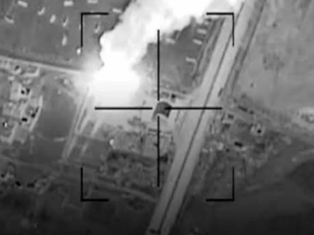
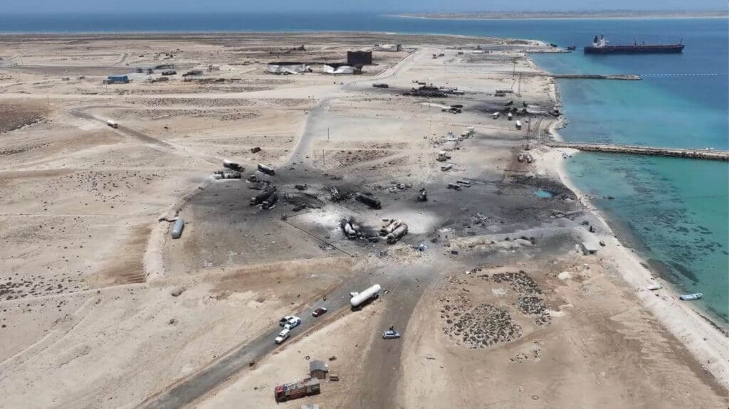
- The coalition acknowledged an operation against Houthi resources on 1 November, but available reporting does not verify Ras Isa as a target or independently establish damage there. Houthi-aligned sources reported four people wounded at the Ras Isa pier and three at an oil facility in Bajil; a trade publication reported that at least two commercial vessels at Ras Isa were targeted. Most site-specific detail comes from Houthi-aligned accounts or a single trade-publication report. (Confidence: low · REPORTED)
- I&W: A coalition statement names Ras Isa as a target, or independent imagery and port or vessel reporting confirm strike damage. (0-14 days)
- I&W: The port operator or independent imagery verifies that the berth and reported vessels were unaffected. (0-14 days)
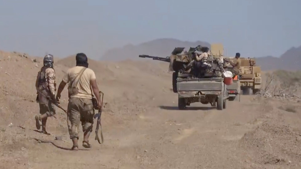
- Current Houthi control of Mocha, Dhubab and Perim Island is not established. One report says Houthi forces seized the three sites in September; another says Saudi-backed Yemeni government forces retook positions overlooking Bab el-Mandeb on 5 October, but does not resolve control of those specific sites. (Confidence: low · REPORTED)
- I&W: Geolocated imagery or named-unit reporting identifies which force physically holds Mocha, Dhubab and Perim Island. (0-30 days)
- I&W: New claims about control of the three sites remain incompatible, with no geolocated independent evidence available. (0-30 days)
Outlook & scenarios
Persistent threat without closure (55%)
Houthi threats and Saudi-led coalition activity persist. Attacks and interceptions continue, while commercial operators maintain some diversions. Bab el-Mandeb remains open to traffic.
Retaliation expands around ports and Saudi targets (25%)
Coalition operations against Houthi resources are followed by further Houthi strikes on Saudi targets. Additional attacks or damage reports involving commercial vessels or Red Sea port facilities increase routing risk and intensify disruption.
A pause allows partial transit recovery (15%)
The parties announce a stand-down and the reporting of attacks and interceptions declines. Shipping companies gradually restore some Red Sea transits, while retaining precautions against renewed attacks.
Wildcard: temporary suspension of Bab el-Mandeb traffic (5%)
A successful attack on a commercial vessel transiting Bab el-Mandeb prompts operators to suspend passage temporarily. Vessels divert around the Cape of Good Hope while the incident and threat are assessed.
Recommendations
- Track AIS-based vessel transits through Bab el-Mandeb and the Gulf of Aden daily, recording diversions and incident reports separately from activity in the Strait of Hormuz.
- Keep the coalition's acknowledged operation distinct from the unverified Ras Isa target and damage reports. Seek confirmation through coalition statements, port or vessel reporting, and independent imagery before treating specific damage or casualty figures as established.
- Maintain a dated, source-attributed control map for Mocha, Dhubab, Perim Island and positions overlooking Bab el-Mandeb. Do not present claims of control as confirmed without location-specific evidence.
Confidence & uncertainty
Overall confidence is high for the broad pattern of renewed fighting, continuing maritime risk and the coalition's announced 1 November operation. Reporting across major media, wire services, trade outlets and official statements supports that pattern. The source accounts are not wholly independent, and the specific Ras Isa damage reports and current control of Mocha, Dhubab and Perim Island remain uncertain; confidence in those judgments is therefore low.
Intelligence gaps
- [EEI 1.1 · PARTIAL] Incidents of hostile action against commercial vessels: vessel name/IMO, position (lat/long), time/date, observable damage or casualties, and weapon type reported (missile, drone, small-arms, explosive-laden boat). Recommended collection: maritime/AIS
- [EEI 1.2 · PARTIAL] Public Houthi claims of attacks or warnings tied to specific dates/routes, including social-media posts, official statements, and timing relative to merchant transits. Recommended collection: open-source/social_media
- [EEI 1.3 · UNCOVERED] Unusual Houthi force posture indicators along Yemen’s Red Sea coast: movement or concentration of small boats, visible coastal missile/rocket emplacements, or logistics buildup at known launch sites (locations, timestamps). Recommended collection: imagery/satellite
- [EEI 1.4 · UNCOVERED] Intercepts or communications indicating orders, targeting lists, or intent to strike merchant shipping (messages referencing specific vessel classes, companies, or chokepoints). Recommended collection: signals/communications
- [EEI 2.1 · UNCOVERED] Reports or visual confirmation of floating or moored mines and debris fields in shipping lanes or approaches to Bab-el-Mandeb, with geolocation and time. Recommended collection: imagery/satellite
- [EEI 2.2 · UNCOVERED] Detection of mine-laying activity: small vessels loitering in lane approaches, unexpected AIS track patterns consistent with mine deployment, or salvage/mining vessels operating in the area. Recommended collection: maritime/AIS
- [EEI 2.3 · PARTIAL] Hydrographic notices, naval warnings, or port authority advisories closing lanes or imposing route restrictions (text of Notice to Mariners, issuing agency, effective times/areas). Recommended collection: naval/port_authority
- [EEI 2.4 · UNCOVERED] Naval or commercial reports of mine-countermeasure operations or confirmed mine removal events (location, time, platforms involved). Recommended collection: naval/intelligence
- [EEI 3.1 · PARTIAL] Movements and presence of foreign warships and support vessels: names/classes, task group compositions, patrol areas and timelines, and whether vessels are conducting escort or interdiction operations. Recommended collection: naval/intelligence
- [EEI 3.2 · PARTIAL] Official announcements or directives from states/coalitions regarding convoys, armed escorts, protected corridor establishment, or changes to rules of engagement for merchant protection. Recommended collection: diplomatic/public_affairs
- [EEI 3.3 · UNCOVERED] Recorded interactions between naval forces and vessels in the corridor (hailings, boardings, warnings, defensive strikes), including timestamps and outcomes. Recommended collection: maritime/AIS
- [EEI 3.4 · PARTIAL] Planned or ongoing multinational exercises, air ISR sorties, or logistics moves that increase or decrease naval capacity in the area (exercise name, participating units, dates, locations). Recommended collection: open-source/military_reporting
- [EEI 4.1 · PARTIAL] Transit volume and pattern changes: number of commercial transits per day/week through Bab-el-Mandeb and southern Red Sea compared with baseline, and instances of rerouting around Africa (position/time data). Recommended collection: maritime/AIS
- [EEI 4.2 · UNCOVERED] War-risk and hull insurance coverage changes: issuance refusals, premium increases for Red Sea transits, or explicit route exclusions by underwriters (policy notices or market rate data with dates). Recommended collection: commercial/insurance_data
- [EEI 4.3 · PARTIAL] Freight and charter market signals tied to the corridor: spot rates for container, tanker, and dry bulk routes affected by Red Sea disruptions, and reported port congestion or turnaround-time increases at nearby hubs. Recommended collection: commercial/market_data
- [EEI 4.4 · PARTIAL] Incidents of cargo denial or diversion for critical goods (crude oil, refined products, LNG, high-value container cargo) including vessel IDs, cargo type, reroute/turnback actions, and economic impact estimates where available. Recommended collection: maritime/AIS
Red cell review: CONCUR WITH COMMENT
TLP:CLEAR