TLP:CLEAR · Disclosure is not limited.
Red Sea Shipping: Elevated Threat, No Verified Closure
Time window: Last 7 days · Audience: General analyst · Type: Situation report · DTG: 2026-11-02 01:13Z · Overall confidence: HIGH
BLUF
Commercial shipping around Bab el-Mandeb is likely to remain exposed to Houthi-related threats, but the reporting does not establish that the strait is closed. Houthi claims of airstrikes on Ras Isa port on 1 November warrant verification; neither the damage nor responsibility is independently confirmed in the available reporting.
Executive summary
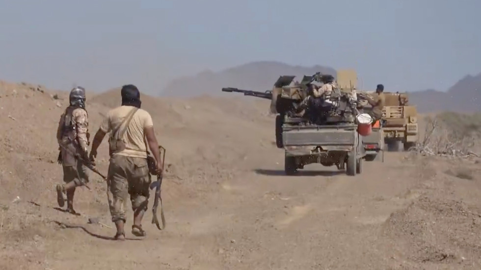
Reported: fighting has intensified on Yemen’s side of Bab el-Mandeb, and the Houthis said airstrikes hit Ras Isa port, a berth and a commercial vessel docked there on 1 November. Marco Rubio said fuel flows through the affected area were comparable with pre-conflict levels, but the claims provide no current vessel-transit count. Assessment: the threat to shipping remains active, while the scale of disruption, the Ras Isa damage and Houthi control of specific coastal sites remain uncertain.
Change from previous assessment
Since the 1 November prior brief, reporting adds intensified fighting on Yemen’s side of Bab el-Mandeb and the Houthi report of airstrikes on Ras Isa on 1 November. I retain the assessment of elevated shipping exposure, but this week’s claims provide no new Bab el-Mandeb transit count, so the traffic trend cannot be updated. Confidence in claims of Houthi control over the coast and nearby sites remains low because the reported September dates lack a year and current control is not independently confirmed.
Key judgments
- Commercial shipping around Bab el-Mandeb is likely to remain exposed to Houthi-related threats over the next 0-14 days, but current reporting does not establish a complete closure. Reporting describes intensified fighting on Yemen’s side of the strait, and Marco Rubio said US forces had defended ships from drones and missiles almost nightly. Rubio also said fuel flows through the affected area were comparable with pre-conflict levels; the available claims provide no independent vessel-transit count. (Confidence: medium · ASSESSED)
- I&W: JMIC or UKMTO reports a confirmed Houthi-attributed missile or drone incident involving a named commercial vessel in Bab el-Mandeb or the Gulf of Aden. (0-14 days)
- I&W: JMIC or UKMTO reports no confirmed Red Sea or Gulf of Aden vessel incidents for 14 consecutive days, while published weekly transit counts show commercial passages increasing. (0-1 month)
- Current Houthi control of Mocha, Dhubab, Perim Island and the entire Yemen Red Sea coast is not established. Reports say Houthi forces seized Mocha, Dhubab and Perim Island in September and took full control of the coast, but the year of the reported September seizures is unspecified; separate reporting says fighting has intensified on Yemen’s side of Bab el-Mandeb. Confidence is low because the control claims are not date-resolved and the current fighting does not independently verify who holds those sites. (Confidence: low · ASSESSED)
- I&W: Independent reporting confirms current Houthi forces or administration at Mocha, Dhubab and Perim Island. (0-1 month)
- I&W: Verified reporting identifies the September seizures as earlier events, or confirms that Yemeni government forces hold one or more of the three sites. (0-1 month)
- The Houthis’ report that airstrikes hit Ras Isa port, a berth and a docked commercial vessel on 1 November is not independently verified; responsibility for the strikes is also unconfirmed. The account was carried by a wire service and attributed by Houthi media to Saudi Arabia, while a separate social-media claim also reported Saudi strikes. Confidence is low because the available accounts do not independently confirm the damage or attribution. (Confidence: low · REPORTED)
- I&W: Independent imagery or vessel reporting confirms fresh strike damage to the Ras Isa berth or the commercial vessel said to have been docked there. (0-14 days)
- I&W: An independent damage assessment finds no strike damage at Ras Isa, or credible reporting identifies a different cause or location. (0-14 days)
Outlook & scenarios
Threat persists while passage continues (60%)
Houthi-related threats and fighting on Yemen’s side of Bab el-Mandeb persist, while commercial vessels continue to transit. The strait remains exposed, but there is no verified full closure or current traffic series to measure the disruption.
Further attacks widen the shipping risk (25%)
If strikes on Yemeni port infrastructure recur and a commercial vessel is confirmed hit, operators are likely to reduce passages through Bab el-Mandeb or seek additional protection. This scenario would raise the risk of a wider Saudi-Houthi exchange affecting the Red Sea approaches.
Diplomatic contacts constrain escalation (10%)
The 26 October meeting in Tehran involving Saudi, Turkish and Pakistani officials and the 23 October ministerial discussions in Istanbul contribute to restraint. Fighting continues, but neither side expands attacks on commercial shipping.
Renewed US attacks on Iran widen the conflict (5%)
If reported US plans for renewed attacks on Iran after 3 November proceed, the conflict would likely widen and increase maritime risk across the Red Sea and Bab el-Mandeb. This is a low-probability, high-impact scenario, not the central outlook.
Recommendations
- Maintain separate Red Sea and Bab el-Mandeb reporting from Strait of Hormuz reporting. Do not use Hormuz incident or transit figures as a proxy for Red Sea passage.
- For the next 14 days, compare JMIC and UKMTO incident notices with available vessel-transit reporting. Record the date, location, vessel, damage and attribution separately.
- Seek independent confirmation of damage at Ras Isa before assessing the port’s status or attributing the reported strikes to Saudi Arabia.
- Do not describe the Houthis as holding the entire Yemen Red Sea coast, Mocha, Dhubab or Perim Island without date-specific confirmation of current control.
Confidence & uncertainty
Overall confidence is high for the broad assessment that maritime risk remains an active concern: major-media reporting, wire coverage and official remarks from Marco Rubio and Fahd Al-Ghafili support that picture. This headline confidence does not extend to current traffic levels, the reported damage at Ras Isa or present Houthi control of coastal sites. The available claims lack a current transit series, and the Ras Isa and territorial-control reporting remains unverified or date-ambiguous.
Intelligence gaps
- [EEI 1.1 · PARTIAL] Incidents of hostile action against commercial vessels: vessel name/IMO, position (lat/long), time/date, observable damage or casualties, and weapon type reported (missile, drone, small-arms, explosive-laden boat). Recommended collection: maritime/AIS
- [EEI 1.2 · PARTIAL] Public Houthi claims of attacks or warnings tied to specific dates/routes, including social-media posts, official statements, and timing relative to merchant transits. Recommended collection: open-source/social_media
- [EEI 1.3 · PARTIAL] Unusual Houthi force posture indicators along Yemen’s Red Sea coast: movement or concentration of small boats, visible coastal missile/rocket emplacements, or logistics buildup at known launch sites (locations, timestamps). Recommended collection: imagery/satellite
- [EEI 1.4 · UNCOVERED] Intercepts or communications indicating orders, targeting lists, or intent to strike merchant shipping (messages referencing specific vessel classes, companies, or chokepoints). Recommended collection: signals/communications
- [EEI 2.1 · UNCOVERED] Reports or visual confirmation of floating or moored mines and debris fields in shipping lanes or approaches to Bab-el-Mandeb, with geolocation and time. Recommended collection: imagery/satellite
- [EEI 2.2 · UNCOVERED] Detection of mine-laying activity: small vessels loitering in lane approaches, unexpected AIS track patterns consistent with mine deployment, or salvage/mining vessels operating in the area. Recommended collection: maritime/AIS
- [EEI 2.3 · UNCOVERED] Hydrographic notices, naval warnings, or port authority advisories closing lanes or imposing route restrictions (text of Notice to Mariners, issuing agency, effective times/areas). Recommended collection: naval/port_authority
- [EEI 2.4 · UNCOVERED] Naval or commercial reports of mine-countermeasure operations or confirmed mine removal events (location, time, platforms involved). Recommended collection: naval/intelligence
- [EEI 3.1 · UNCOVERED] Movements and presence of foreign warships and support vessels: names/classes, task group compositions, patrol areas and timelines, and whether vessels are conducting escort or interdiction operations. Recommended collection: naval/intelligence
- [EEI 3.2 · UNCOVERED] Official announcements or directives from states/coalitions regarding convoys, armed escorts, protected corridor establishment, or changes to rules of engagement for merchant protection. Recommended collection: diplomatic/public_affairs
- [EEI 3.3 · UNCOVERED] Recorded interactions between naval forces and vessels in the corridor (hailings, boardings, warnings, defensive strikes), including timestamps and outcomes. Recommended collection: maritime/AIS
- [EEI 3.4 · UNCOVERED] Planned or ongoing multinational exercises, air ISR sorties, or logistics moves that increase or decrease naval capacity in the area (exercise name, participating units, dates, locations). Recommended collection: open-source/military_reporting
- [EEI 4.1 · PARTIAL] Transit volume and pattern changes: number of commercial transits per day/week through Bab-el-Mandeb and southern Red Sea compared with baseline, and instances of rerouting around Africa (position/time data). Recommended collection: maritime/AIS
- [EEI 4.2 · UNCOVERED] War-risk and hull insurance coverage changes: issuance refusals, premium increases for Red Sea transits, or explicit route exclusions by underwriters (policy notices or market rate data with dates). Recommended collection: commercial/insurance_data
- [EEI 4.3 · PARTIAL] Freight and charter market signals tied to the corridor: spot rates for container, tanker, and dry bulk routes affected by Red Sea disruptions, and reported port congestion or turnaround-time increases at nearby hubs. Recommended collection: commercial/market_data
- [EEI 4.4 · PARTIAL] Incidents of cargo denial or diversion for critical goods (crude oil, refined products, LNG, high-value container cargo) including vessel IDs, cargo type, reroute/turnback actions, and economic impact estimates where available. Recommended collection: maritime/AIS
Red cell review: CONCUR
TLP:CLEAR