TLP:CLEAR · Disclosure is not limited.
South China Sea: Huangyan Patrols and Persistent Chinese Pressure
Time window: Last 7 days · Audience: General analyst · Type: Situation report · DTG: 2026-09-03 10:06Z · Overall confidence: HIGH
BLUF
China is likely to sustain China Coast Guard activity around Huangyan Island, also known as Scarborough Shoal, after reported patrols on 1 and 30 August and a statement that patrols strengthened during August. The reporting supports persistent law-enforcement pressure, but the 2-3 September NASA thermal detections do not establish a conflict-related event.
Executive summary
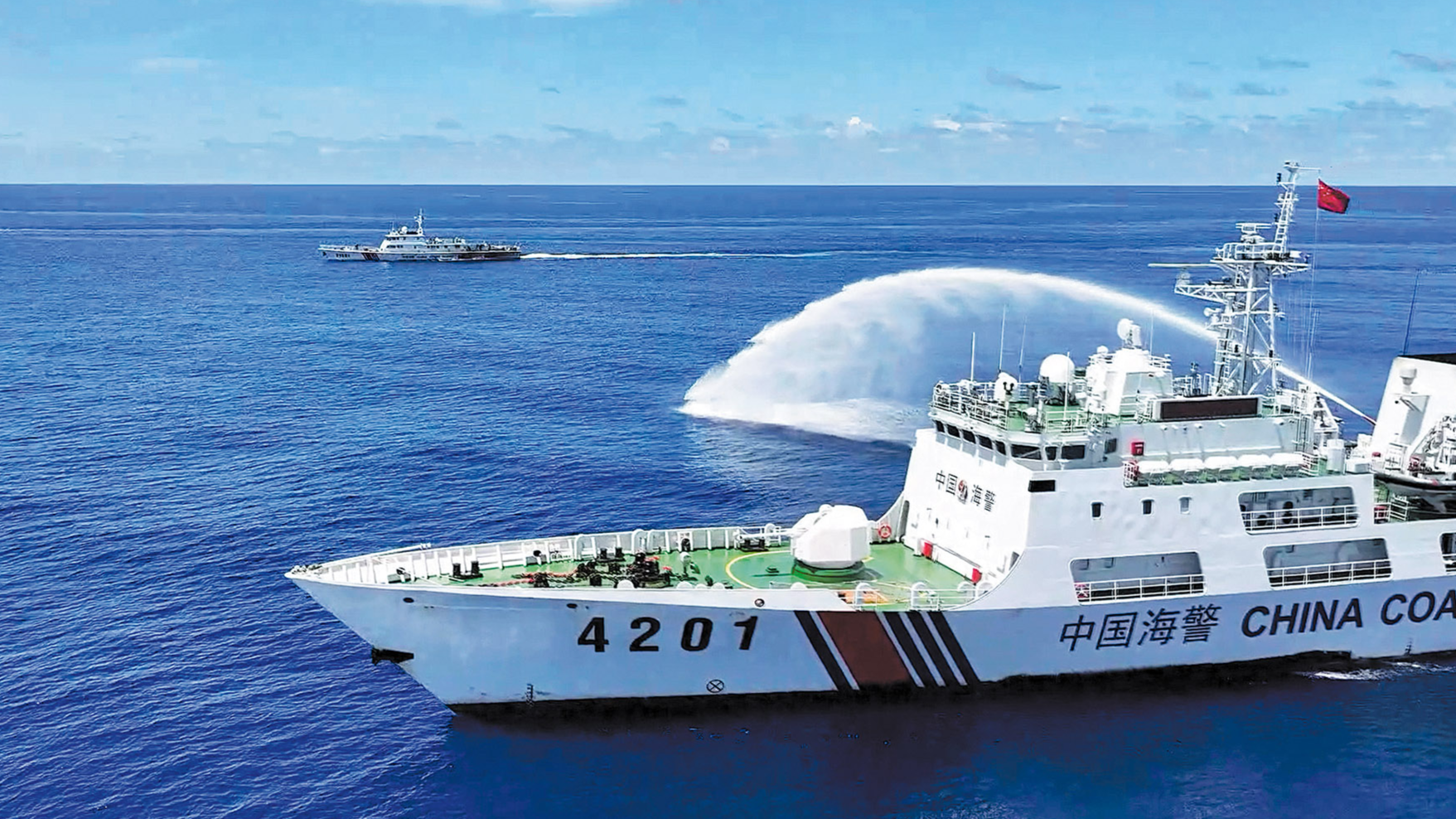
The China Coast Guard reported law-enforcement patrols in the territorial waters of Huangyan Island on 30 August and said patrols had strengthened since August. Earlier reporting placed China Coast Guard vessels near Huangyan Island during rights-protection drills on 1 August. China has controlled Scarborough Shoal since 2012, declared a nature reserve there in September 2025, and deployed a floating structure and buoys over Philippine protests. Beijing continues to reject the 2016 arbitral ruling while asserting a dashed-line claim covering approximately 62% of the South China Sea, although it has not defined the line's meaning. NASA FIRMS recorded 14 thermal detections in parts of the Philippines on 2-3 September, but the data identify heat rather than cause.
Change from previous assessment
This brief adds named China Coast Guard patrol reporting at Huangyan Island on 30 August and a China Coast Guard account that patrols strengthened during August. The prior brief forecast sustained Chinese maritime pressure but noted no new named encounter during its reporting window. Confidence in continued patrol activity therefore rises from forecast-only to medium-confidence reported activity, while no assessment of an imminent armed exchange is added because the current claims provide no direct evidence of one. The new NASA FIRMS detections are treated as non-attributive rather than as evidence of maritime escalation.
Key judgments
- China is likely to sustain China Coast Guard patrol activity around Huangyan Island over the next 1-3 months. The reported pattern includes patrols during rights-protection drills on 1 August, a 30 August law-enforcement patrol, and a China Coast Guard statement that patrols strengthened during August. This is an assessed forecast rather than evidence of preparations for an imminent attack. Confidence is medium because the operational reporting is based partly on China Coast Guard statements relayed by major media and does not independently establish the full patrol tempo. (Confidence: medium · ASSESSED)
- I&W: CONFIRM: A new China Coast Guard statement or independently reported sighting identifies law-enforcement or rights-protection patrols near Huangyan Island. (0-14 days)
- I&W: BREAK: China Coast Guard reporting states that patrols near Huangyan Island have stopped, with no additional patrol activity identified. (1-3 months)
- China is very likely to maintain a persistent physical and administrative position at contested South China Sea features, with Scarborough Shoal the clearest reported case. China has controlled Huangyan Island since 2012, declared a nature reserve there in September 2025, and deployed a floating structure and buoys over Philippine protests. A US Department of Defense assessment also reports that China's artificial outposts enable a flexible and persistent military and paramilitary presence in the South China Sea. Confidence is medium because the evidence combines high-confidence reporting with a medium-confidence account of China's control and does not independently verify the current status of every marker or outpost. (Confidence: medium · ASSESSED)
- I&W: CONFIRM: Reporting identifies additional floating structures, buoys, or other Chinese physical installations at or around Huangyan Island or China's artificial outposts in the Spratly Islands. (1-3 months)
- I&W: BREAK: Reporting confirms removal of the floating structure and buoys at Huangyan Island and no replacement or expansion of Chinese physical markers. (1-3 months)
- China is very likely to continue rejecting the 2016 arbitral ruling while maintaining an expansive maritime position in the South China Sea. China has declared the ruling null and void, asserts a dashed line covering approximately 62% of the South China Sea, and has not definitively explained what the line or its reference to adjacent waters means. The tribunal ruled that Spratly Islands land features cannot generate an exclusive economic zone and found that China violated Philippine sovereign rights in the Philippines' exclusive economic zone. Confidence is high for the core assessment because multiple high-confidence major-media claims support China's stated position and the tribunal's findings. Confidence is lower on the precise geographic and legal meaning of the dashed line. (Confidence: high · ASSESSED)
- I&W: CONFIRM: Chinese official statements again describe the 2016 ruling as null and void or reassert the dashed-line claim. (0-14 days)
- I&W: BREAK: Chinese official statements accept the tribunal's findings or formally narrow the stated maritime claim. (1-3 months)
- It is very unlikely that the 14 NASA FIRMS VIIRS detections recorded in parts of the Philippines on 2-3 September, including one high-confidence detection, will by themselves demonstrate Chinese maritime activity or a conflict-related incident. NASA FIRMS assesses that thermal signatures record heat rather than cause and can reflect strikes, shelling, industrial fires, or wildfires. Confidence is high on the limitation of the data and medium to high on the attribution judgement because the detections are official but lack a reported cause or a location-specific link to Huangyan Island. (Confidence: high · ASSESSED)
- I&W: CONFIRM: Subsequent review continues to list the detections only as unattributed thermal anomalies, without a named maritime incident or cause. (0-14 days)
- I&W: BREAK: Official or independent reporting links a high-confidence detection to a specific strike, shelling incident, industrial fire, or named event at a reported location. (0-14 days)
Outlook & scenarios
Sustained China Coast Guard presence at Huangyan Island (65%)
China Coast Guard patrols near Huangyan Island continue and are described as law-enforcement or rights-protection activity. The floating structure and buoys remain in place, while the United States and the Philippines continue to reject China's nature reserve declaration as unlawful. This is the likely baseline over the next 1-3 months.
Broader feature competition and legal standoff (45%)
China maintains activity around Huangyan Island while the wider South China Sea dispute remains centred on competing sovereignty claims, China's dashed-line position, the 2016 arbitral ruling, and construction on contested features. Vietnam's reported reclamation since 2021 adds another source of feature competition, but the supplied reporting does not establish a new confrontation involving Vietnam during this reporting window.
Temporary operational pause (20%)
China Coast Guard reporting near Huangyan Island falls quiet for several weeks, with no reported expansion of the floating structure or buoys. The legal dispute and China's rejection of the 2016 ruling continue despite a lower visible patrol tempo. This outcome is unlikely but consistent with a temporary adjustment rather than a change in China's stated position.
Localised encounter with wider diplomatic effects (10%)
A China Coast Guard interaction with a Philippine vessel at Huangyan Island becomes a named incident and prompts a formal response from the Philippines and the United States. This is a very unlikely, high-impact path in the supplied evidence because current reporting identifies patrol activity but does not report a new encounter, collision, or armed exchange.
Recommendations
- Prioritise a 0-14 day collection watch for China Coast Guard statements, patrol reports, and vessel sightings near Huangyan Island. Record whether each report identifies law-enforcement activity, rights-protection drills, or action against vessels described as engaged in illegal activities.
- Maintain a dated baseline of the floating structure and buoys around Scarborough Shoal. Treat additions, relocation, removal, or replacement as separate indicators of a change in China's physical presence.
- Keep NASA FIRMS detections in a separate, unattributed incident file until a named source links a specific detection to a cause and location. Do not use the 2-3 September detections as standalone evidence of Chinese maritime activity.
- Track Chinese statements on the 2016 arbitral ruling, the dashed-line claim, and adjacent waters as separate legal and policy indicators. Avoid treating the approximately 62% figure as a precise map of China's operational activities because the supplied reporting says Beijing has not defined the line's meaning.
- Seek independent corroboration of any reported Philippine vessel interaction near Huangyan Island and log any subsequent US or Philippine diplomatic statement separately from China's account.
Confidence & uncertainty
Overall confidence is high for the core situation picture because official NASA FIRMS data, a US Department of Defense assessment reported by major media, and major-media reporting on China Coast Guard activity and China's legal position support one another. The main uncertainties concern the true China Coast Guard patrol tempo, the purpose of activity near Huangyan Island, the precise meaning of the dashed-line claim, and the cause of the NASA thermal detections. The China Coast Guard activity claims themselves carry medium confidence because they rely partly on statements from the organisation conducting the patrols.
Intelligence gaps
- [EEI 1.1 · PARTIAL] Number, class, and position (time-stamped) of Chinese Coast Guard (CCG), People’s Armed Forces Maritime Militia (PAFMM), and other PRC paramilitary/auxiliary vessels inside Philippine-claimed EEZ or within 12 nautical miles of Philippine-occupied features (e.g., Scarborough Shoal, Second Thomas/Ayungin Shoal, and other named features). Recommended collection: maritime/AIS
- [EEI 1.2 · PARTIAL] Observed maneuvers or posture indicating hostile action: vessel-to-vessel blocking/contact, use of water cannons, boarding attempts, formation maneuvers to interdict Philippine vessels, or sustained stationing near Philippine resupply/relief routes. Recommended collection: imagery/satellite
- [EEI 1.3 · UNCOVERED] Incidents of Philippine vessels (coast guard, navy, supply boats, civilian fishing vessels) being ordered to alter course, detained, chased, or physically impeded, with time, location, involved units, and damage/injuries if any. Recommended collection: open-source/official statements
- [EEI 1.4 · UNCOVERED] Abrupt changes to vessel identification behavior: AIS transponder deactivations, spoofing, or mismatches between flagged identity and observed equipment/markings among PRC maritime law-enforcement or militia vessels operating near Philippine claims. Recommended collection: maritime/AIS
- [EEI 2.1 · PARTIAL] Issued directives, patrol orders, or internal guidance from PRC Central Military Commission, PLAN, CCG, or provincial maritime authorities that specify objectives, geographic limits, patrol tempos, or escalation thresholds for operations near Philippine-claimed features. Recommended collection: signals/communications
- [EEI 2.2 · PARTIAL] Public declarations, maritime notices, or newly published 'maritime safety' or exclusion zones, with effective dates and coordinates, issued by Chinese authorities that could be used to justify interdiction or exclusion of Philippine activity. Recommended collection: open-source/official statements
- [EEI 2.3 · UNCOVERED] Evidence of mobilization orders, tasking lists, or logistics planning for Maritime Militia units (vessel requisitions, local fisheries bureau instructions, fuel/resupply manifests) indicating intent to employ militia alongside CCG/PLAN assets. Recommended collection: HUMINT/defense
- [EEI 3.1 · UNCOVERED] Deployment and movement of Philippine Coast Guard and Navy vessels (class, location, on-station times) and scheduled or unscheduled escort/resupply missions to occupied features. Recommended collection: military/AIS
- [EEI 3.2 · UNCOVERED] Air component activity: number and frequency of Philippine air patrol sorties, maritime domain awareness flights, and air-to-surface or maritime strike assets placed on alert or redeployed toward contested areas. Recommended collection: imagery/satellite
- [EEI 3.3 · UNCOVERED] Requests for diplomatic, intelligence, or military assistance from allies (e.g., US, Australia, Japan) including notifications of planned joint patrols, port calls, or freedom of navigation operations with dates and participating units. Recommended collection: open-source/official statements
- [EEI 3.4 · UNCOVERED] Changes to Philippine rules of engagement, emergency law measures, mobilization orders, or civil advisories (evacuations, fishing bans) that alter civilian or military behavior in contested maritime zones. Recommended collection: open-source/official statements
Red cell review: CONCUR WITH COMMENT
TLP:CLEAR